
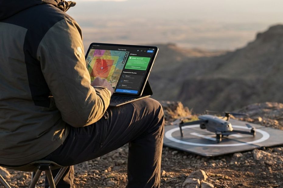
If you want dependable drone flight planning in the U.S. in 2026, you need two capabilities covered: airspace awareness (where you can and can’t fly) and mission planning (how you’ll fly, capture, and repeat the job). The five tools below cover those needs across recreational flying, Part 107 work, mapping, inspection, and automated waypoint missions.
This guide keeps you out of preventable trouble, reduces failed missions, and helps you match the right tool to the way you actually fly. You’ll get a clear recommendation for what replaced “the B4UFLY app,” when LAANC matters, which apps perform best offline, and which platforms deliver repeatable mapping or cinematic automation without wasting batteries in the field.
1. Aloft (Air Control, Air Aware)
If you fly in the United States and you care about staying aligned with FAA workflows, Aloft is the most practical anchor app to keep on the phone. It covers the two preflight questions that block more flights than weather ever does: “Am you allowed here,” and “Do you need authorization before takeoff.” Aloft’s Air Aware product is positioned around B4UFLY-style situational awareness, and Air Control is positioned around LAANC authorization when controlled airspace is involved. That pairing matters because pilots regularly lose time bouncing between apps right before a launch.
Aloft also fits how real operations run: you check airspace early, you confirm again at the site, then you document what happened. Airspace awareness is not a one-time step at the desk, it is a field habit. When airspace changes fast due to a TFR or airport activity, having a tool designed for FAA data pathways protects the schedule and protects the certificate. A strong default setup for many pilots is Aloft for airspace and authorization, then a mission tool (DroneDeploy, UgCS, Dronelink, or Litchi) for the actual flight pattern and capture.
Best fit: U.S. recreational flyers and Part 107 pilots who want an FAA-aligned app for awareness and LAANC in one place, plus teams that want consistent preflight discipline across multiple pilots.
What to watch: Aloft handles “can you fly,” then you still need the right mission tool for mapping grids, corridor work, or complex automation depending on the aircraft and job type.
2. DroneDeploy
DroneDeploy is built for repeatability and coverage, which is the difference between a “good flight” and a “usable dataset.” When the job involves mapping, construction progress, volumetrics, roof documentation, or inspection capture that must line up week after week, DroneDeploy’s planning focus becomes a performance advantage. You spend less time rebuilding flight plans and less time discovering gaps when processing the data back at the office.
Field reliability is also where DroneDeploy earns its keep. When connectivity drops, many pilots lose basemaps, boundaries, and confidence at the exact moment the aircraft is ready to launch. DroneDeploy documents an Offline Flight Planning workflow where you store the map base layer on a mobile device or supported controller so you can plan and fly without internet in remote areas. The operational detail that matters is storage management: it documents a limit of up to 10 project base maps stored offline, which pushes you to manage offline projects intentionally rather than hoard everything. That’s the kind of detail that prevents “blank map” surprises when you show up at a site with no cell service.
Best fit: Mapping and inspection teams who run standardized capture, need clean handoffs between pilots, and want fewer mission rebuilds across repeat visits.
What to watch: You still need to handle airspace awareness and LAANC through an FAA-approved provider when required, and you need to confirm aircraft/controller compatibility for the exact workflow.
3. UgCS (SPH Engineering)
UgCS is built for the jobs where “simple grid” planning stops working. Corridor missions, terrain-heavy sites, infrastructure linear assets, and operations that demand terrain-following control require a planning environment that thinks in 3D. UgCS is positioned around advanced mission planning, including terrain-aware workflows and professional planning features that support demanding capture patterns. When the goal is consistent altitude above ground and stable capture geometry along a route, UgCS is the kind of tool that prevents sloppy datasets and unsafe altitude decisions.
Offline capability is also a serious differentiator for UgCS-style workflows. Remote work sites, secure environments, and operations in areas with poor connectivity cannot depend on live map tiles or cloud-only planning. UgCS is marketed as usable fully offline, which aligns with what enterprise and utility operators need: local planning, controlled data movement, and predictable operations even when the phone has no signal. When the job is high accountability and low tolerance for surprises, “works offline” is not a convenience feature, it is a mission requirement.
Best fit: Professional operators doing corridor mapping, terrain-dependent planning, and mission profiles that need more control than consumer waypoint apps deliver.
What to watch: UgCS is powerful, and that power comes with setup and planning discipline. It rewards crews that standardize profiles and treat planning like an engineering step, not a last-minute step.
4. Dronelink
Dronelink is a strong choice when you want customizable automation without being locked into a single capture pattern. Many real missions are mixed: you might map a footprint, then orbit a structure, then run facade passes, then capture a panorama sequence for documentation. Dronelink is designed around building and combining mission components, which matches the way pilots actually work when they are paid for outcomes rather than paid for airtime.
Preflight clarity is another reason Dronelink stands out for mission design. A planning tool that lets you preview the path and camera behavior before takeoff reduces wasted batteries and reduces resets in the field. That matters when a site window is short, winds are rising, or the client is waiting for a deliverable. You get a cleaner first flight, and you spend less time “testing” in the air while the clock runs.
Best fit: Pilots who want flexible automation, structured mission building, and preflight visibility for complex capture runs on supported aircraft ecosystems.
What to watch: Automation is only as good as your preflight checks. You still need airspace awareness, local takeoff/landing permission, and a clear plan for battery, link quality, and contingency actions.
5. Litchi
Litchi remains a practical waypoint planning option when you want repeatable routes and you do not want an enterprise mapping stack. It is positioned around waypoint missions and planning workflows that can be prepared ahead of time and reused. For many pilots, that is the core requirement: build a clean mission once, then execute it reliably across multiple sessions without constantly rebuilding the route on a small screen.
Litchi also fits budget reality. Many pilots need professional-looking results, consistent flight paths, and predictable automation, yet they do not need a full mapping platform with team features. In that lane, Litchi earns its spot by focusing on the mission planning that most directly affects results: waypoints, route repeatability, and smooth execution. When you pair it with a strong airspace awareness tool, it becomes a dependable “everyday automation” option.
Best fit: Pilots who want budget-friendly waypoint planning and repeatable missions for supported DJI workflows.
What to watch: A waypoint tool does not replace FAA awareness and authorization steps. Treat it as mission execution software, not compliance software.
What Replaced The FAA B4UFLY App, And Which One Should You Use Now?
The FAA no longer positions B4UFLY as a single app you download and keep forever. It now positions B4UFLY as a service provided through FAA-approved companies via desktop and mobile applications, and it states that starting February 1, 2024 recreational flyers have more resources to choose from. The FAA’s B4UFLY page lists five approved providers: Airspace Link, Aloft, AutoPylot, Avision, and UASidekick, and it shows availability across iOS, Android, and desktop. The same FAA page shows a “Last updated” date of July 31, 2025, which is useful when confirming the list is current for 2026 planning.
If one recommendation is required without overthinking it, select a provider that matches how you fly. When LAANC is a frequent need, a provider that also handles LAANC in the same ecosystem reduces switching cost on launch day. When the work is mostly uncontrolled airspace and the priority is quick situational awareness checks, any FAA-approved B4UFLY provider can cover the basics. Keep the decision practical: the best pick is the one that the phone actually opens quickly, the team actually uses, and the interface makes it hard to miss a red flag.
How Do You Check If You’re Allowed To Fly At A Location And Get LAANC Authorization?
Start with airspace awareness, then move to authorization when controlled airspace is involved. The FAA describes B4UFLY as a service that shows where recreational flyers can and cannot fly, and it highlights situational awareness features like controlled airspace, special use airspace, TFRs, airports, and other key layers. That preflight awareness step prevents the most common field mistake: arriving on site, powering up, then discovering the area requires authorization or has a restriction that blocks the job.
When the location is in controlled airspace around airports, LAANC becomes the operational gate. The FAA describes LAANC as automating the application and approval process for airspace authorizations, with requests checked against multiple data sources, and approvals often delivered in near-real time when eligible. LAANC is also not just for Part 107; it is available for operations under Part 107 and under the exception for recreational flyers, assuming the operation qualifies. Keep the habit simple: confirm the airspace status, submit LAANC when required, then document the authorization details with the flight record.
When Does LAANC Matter, And What Does It Actually Approve?
LAANC matters when the planned operation is under 400 feet in controlled airspace around airports where LAANC is available. The FAA’s explanation focuses on access to controlled airspace at or below 400 feet, awareness of where you can and cannot fly, and visibility for air traffic professionals into when and where drones will operate. It also highlights that LAANC provides airspace authorizations only, so it does not remove the need to check NOTAMs, weather, and other operating requirements that can affect the go/no-go decision.
LAANC does not grant a free pass to fly anywhere. It is an authorization pathway tied to specific location, altitude, and time, and it relies on FAA data sources like UAS Facility Maps, airspace classes, special use airspace data, and TFRs. When pilots treat LAANC like a “green light” without reading the details, flights drift into avoidable violations. Treat it as a precise permission for a precise operation, and keep the discipline of matching the mission plan to the authorized parameters.
Which Tool Should You Use For Mapping, Inspection, And Repeatable Data Capture?
For mapping and inspection capture where repeatability matters, DroneDeploy is a leading fit from this list because its planning workflow is centered on coverage consistency. In practice, the winner in mapping is rarely the app with the most buttons, it is the app that prevents missed strips, prevents inconsistent overlap, and makes it fast to rerun the same plan next week with minimal edits. Mapping teams also benefit from standardizing altitude, overlap, sidelap, and camera angle per asset type so outputs align over time.
Offline planning support is a critical operational detail in this segment. DroneDeploy’s Offline Flight Planning documentation describes saving a project’s map base layer to a device or supported controller so the plan and map stay usable without internet. That single feature prevents a major field failure mode: arriving at a remote site, losing map visibility, and having to guess boundaries. When the work is billable and time on site costs money, offline preparedness protects margins.
Which Tools Work Best Offline Or In Remote Areas With No Cell Service?
Offline performance is a planning decision, not a last-minute convenience. When a tool depends on live tiles, the field team gets punished in the exact locations where drones are most valuable: rural infrastructure, mountainous terrain, and large industrial sites with weak signal. A solid offline workflow means you can still confirm boundaries, execute the mission, and maintain repeatability even when the phone shows zero bars.
From this list, DroneDeploy and UgCS stand out for offline-oriented planning. DroneDeploy documents an offline workflow that stores map base layers on a mobile device or supported controller, with a stated storage limit of up to 10 offline project base maps. UgCS positions itself as usable fully offline, which matches secure or remote operations that need local planning. When offline matters, build it into the checklist: download what you need before leaving coverage, verify the plan shows offline-ready status, and keep storage tidy so the critical site stays cached.
Best App To Replace B4UFLY In 2026
- Use an FAA-approved B4UFLY provider for awareness
- Pick a provider that also supports LAANC if you fly near airports
- Aloft is a strong default for awareness plus LAANC in one ecosystem
Get Your Preflight Stack Dialed In And Fly With Fewer Surprises
Flight planning improves fastest when the toolset matches the job: Aloft covers U.S. airspace awareness and LAANC workflows, DroneDeploy drives repeatable mapping and offline readiness, UgCS handles terrain-heavy and corridor planning, Dronelink supports flexible automation with preflight visibility, and Litchi delivers budget-friendly waypoint repeatability. Keep the split clear between compliance and mission execution, and select tools that reduce app-switching on launch day. Build offline readiness into planning when the site is remote, and treat authorizations as precise permissions tied to time, place, and altitude. When these habits become routine, you launch faster, re-fly less, and deliver cleaner results with fewer field resets.
References
- Federal Aviation Administration (FAA), “B4UFLY” (last updated July 31, 2025): https://www.faa.gov/uas/getting_started/b4ufly
- Federal Aviation Administration (FAA), “UAS Data Exchange (LAANC)”: https://www.faa.gov/uas/getting_started/laanc
- Federal Aviation Administration (FAA), “FAA Expands B4UFLY Services for Drone Pilots” (Feb 1, 2024): https://www.faa.gov/newsroom/faa-expands-b4ufly-services-drone-pilots
- Aloft Help Center, “Aloft: FAA-Approved LAANC & B4UFLY Services”: https://help.aloft.ai/en/articles/10058474-aloft-faa-approved-laanc-b4ufly-services
- DroneDeploy Help Center, “Offline Flight Planning”: https://help.dronedeploy.com/hc/en-us/articles/26263580481943-Offline-Flight-Planning
- SPH Engineering, “UgCS – Drone Flight Planning Software”: https://www.sphengineering.com/flight-planning/ugcs
- Dronelink, “Drone Flight Control” and “Mission Planner”: https://www.dronelink.com/
- Litchi, “Litchi for DJI Drones”: https://flylitchi.com/
- Federal Aviation Administration (FAA), “UAS Facility Maps”: https://www.faa.gov/uas/commercial_operators/uas_facility_maps
- Reddit thread (pilot discussion), “B4UFLY app is no more, which one on this list do you recommend?”: https://www.reddit.com/r/dji/comments/1ansuuu

Jared Ailstock is Managing Partner at AIP Capital with over 15 years of experience in aviation finance and investment. He specializes in global aviation strategy, asset-backed transactions, and sustainable growth across the aerospace industry.